Archive for July, 2011
Last week I decided to get out of the house and get some fresh air. Since March this year I have been working completely 100% remotely here in Antibes. However as of tomorrow, August 1, I will have to go back into the office once again. This isn’t exactly to my liking but necessary to continue employment. (For the record, if any of you reading this needs (…ahem, wants to hire) a great software, web application developer, I’m your guy!)
Remote work has treated me well, allowed me to stay at home and see my daughter every single day. I can say that I’m extremely grateful for that and wish it could continue! I’m going to miss working from home BUT will continue my search for more remote work. I think the best part about working from my home office is that my days aren’t 8 consecutive hours of working. I can work for 4 hrs then break for lunch. After eating & playing with Guilliana, I can then come back to my desk and work a couple more hours. I then typically break for afternoon coffee for an hour to relax, collect my thought, and draw up solutions for whatever software issues I may have encountered during the day/week. After coffee I finish my remaining 2-3 hrs and then call it a day. One last benefit to remote work is my commute. I step outside my office and, across the hallway, Guilliana is playing with her toys where I can join her…immediately!
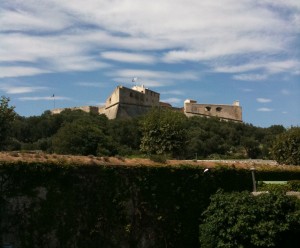
As I was saying…I decided to get some fresh air and hopped on my handcrafted, Canadian-made “Rocky Mountain Slayer 50″ mountain bike and headed off to check out Fort Carre (pronounced Car-ray) and Port Vauban (pronounced vo-bun) both of which just happen to be right down the street from us.
Next time I will have pics from an actual tour of the entire Fort. Unit then…here are last week’s pics…enjoy the slideshow!
Take care, mon amis!
Au revoir!
Actual pics can be found here Fort Carre Album
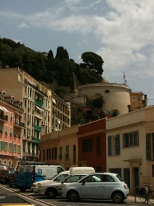
We have a long-time, good friend, Susan Murphy, in town to spend the week with us. It’s great to see a familiar face and in a foreign country where we have only lived for 4.5 months. Good friends, good times! Sue and I decided to take a little adventure into Nice today and check out Colline du Chateau. A quick lookup on Google informed us that we’d be climbing “Castle Hill” and stepping up about 100 stairs. I’m not sure where whomever wrote this information learned arithmetic but it certainly wasn’t 100 steps! Turns out about a third of the way up we figured we’d already climbed 100 steps. And, for the record, on the way down I counted the steps and arrived at approximately 400 steps; give or take a handful.
A little history of Colline du Chateau from Wikipedia (as translated by Google)…
- The castle of Nice is a fortified structure for military purposes, now the xi th in the xviii th century on a hill of rock, overlooking the Bay of Nice . Regarded as a place of worship County of Nice , which occupies the patio location is sometimes known as the “cradle of the sun” for the quality of its views at any time of day either at sunrise or sunset.
Access to the lift hill of the Castle
For the old Nice, the word evokes more a castle hill where became famous heroine Catherine Ségurane or a place to walk the site of one of the strongest fortifications in the Mediterranean arc. Castle Hill is a large limestone rock rising to 93 meters with a top made of two plates: One will set itself up in the south where for seven centuries the castle, just below the first suburbs to the north and later citadel.
The texts report first urban development in xi th century with the presence of a castrum, a cathedral, and a variety of habitats on the upper deck. In the middle of xii th century, the first suburb is built on the plateau north, quickly protected by a wall and into the next century the city of Nice is confined to this space hill. Following the retraction of Nice to Savoy in 1388, the castle (castrum magnum) and speakers are subject to changes and transformations in 1440. The cathedral is rebuilt during this half century.
After damage to the northern suburb in 1543 by the Franco-Turkish siege, the Duke Emmanuel Philibert decided a major overhaul of the defensive system and replaces the suburb by a citadel with bastions, like the works of the Alban Mount and Villefranche. All these decisions for military purposes, accelerate the movement began in the Middle Ages, déperchement habitat to the lower town (now Old Nice), and the transfer of the Cathedral of Our Lady of the castle to St. Reparata.
At the end of the xvii th century, the city is adorned by a wall with bastions and walls work ends just before the siege of 1691 and the storming of the town and castle by the French troops of Catinat . After the Treaty of Turin in 1696 and the return of Nice to Savoy, the Duke of doubling works (pliers, half-moons) of the wall XVI e of the fortress on its flanks vulnerable. Today, by accessing the castle hill, there is a plot of flat land with a splendid view of the capital of the Cote d’Azur.
Third and final siege of the city of Nice and its castle.
The quarrels of the Spanish Succession grow Louis XIV to clash with Victor Amadeus II . In spring 1705, the armies of the King of France commissioned by La Feuillade laid siege to the imposing bastions and towers of the city of Nice, formidable stronghold and led strategic Mediterranean states of Savoy. After several weeks of siege the city surrendered the castle but is resistant to artillery fire from the Duke of Berwick.
As an acropolis, the fortress and the castle overlooking the city from a rocky outcrop surrounded by a wall which was 2 have a radius of 2300 meters and in places about eight meters high. Within the first fortified line, a second wall even more massive and deep, flanked by towers, defines the citadel of the castle. The castle ruin is reduced by 113 guns and mortars three and surrendered after 54 days of bombing, the 4 January 1706.
Batteries around the fort end of December 1705.
Position of the main batteries end in December 1705 around the fortress:
- From November 11, 1705 to January 4, 1706, four batteries are used: 644,296 pounds (322,148 kg) of powder, 14,103 bombs, including 400 in five (2.5 kg), 5225 12 (6 kg), 273 9 (4.5 kg), 8205 18 (9 kg) and 39 045 balls including 29 157 24 (12 kg) and 30 980 (15 kg).
The fortifications of the city, the citadel and castle razed.
Nice Castle in XII th century
From January 2, 1706, Louis XIV gave the order to destroy and screed to the rest of the explosive monumental fortifications untouched by the bombing. He entrusted this task to his advisor Gayot that develops specifications 5 stating: “The contractor will open the blast holes in rocks or land on which the walls are seated, that is to say that start from the first to the last stone of the fortification, so that nothing remains. The walls will be knocked down to the foundations and the covering of ditches. The underground will be demolished. The castle grounds and the castle will be up to 5 wheelbarrow relay (100 meters) away and will be charged the same for the walls and bastions of the city. “On July 12, the work is awarded to a contractor which is provided shovels, picks, powders, sand bags, etc.. And the next day, trumpets and drum rolls announce to the public the schedule of future destruction, and during these six months uninterrupted blasting will cause enormous damage in the urban architectural heritage where everything disappears forever.
The Treaty of Utrecht of 1713 makes it nice and County to Victor Amadeus II. The king gave up the idea of restoring the fortifications to the city and delegates its architect to develop the extension of the Nice suburbs outside its historical limits. After its destruction, the castle will remain in ruins, many years until 1830 when King Charles Felix ordered the creation of a hill with trees and landscaped pathways and embellished with a waterfall . This site offers a panoramic view across the Bay of Angels became the xix th century the place to visit as a priority by all the aristocracy wintering. Napoleon III , the new sovereign after the annexation of Nice to France will be one of the first visitors to report in September 1860: “It’s the most beautiful landscapes I have ever seen, is admirable.”
In 2007, Nice finds its roots in the work of the trams. Archaeological excavations update the vestiges of centuries of development close to the defensive Garibaldi Square , including the remains of a medieval tower and thick bastions leveled in 1706.
Here is Guilliana waking up first thing in the morning after her usual 12-hr night sleep. As you can imagine, 12 hours of sleep results in one HUGE diaper that needs some serious attention! Listen closely as we ask G-Monkey if she needs her diaper changed in both French & English. Not surprisingly her answer doesn’t change! ![]()
We recently were invited to our new friends’ place for a 4th of July get together. Our network of friends is expanding here albeit, our new friends are from Texas. However, when living abroad hanging with people that have chosen the same adventure as us, it’s nice to talk about familiar things. Here is a view from the hilltop in Grasse where our new friends live. Grasse is about 25 mins from where we are in Antibes and it beautiful.
As referenced from Wikipedia…Grasse is the center of the French perfume industry and is known as the world’s perfume capital. Grasse’s particular microclimate encouraged the flower farming industry. It is warm and sufficiently inland to be sheltered from the sea air. There is an abundance of water, thanks to its situation in the hills and the 1860 construction of the Siagne canal for irrigation purposes. The town is 350 m (1,148.29 ft) above sea level and 20 km (12 mi) from the Coast (Côte d’Azur). Jasmine, a key ingredient of many perfumes, was brought to southern France by the Moors in the 16th century. Twenty-seven tonnes of jasmine are now harvested in Grasse annually.
Recently G-Monkey figured out how to tell mommy & daddy what she wants. It’s clear a the day to her so check her out and let me know when/what you figure she wants!
Turns out…she wanted the cordless phone. Who knew! LOL!


